Filipinos are being advised to keep their umbrellas close and monitor local weather advisories in the coming days. The Philippine Atmospheric, Geophysical and Astronomical Services Administration (PAGASA) has officially raised the alarm over a strong tropical cyclone developing far east of the country. While weather conditions across the archipelago currently feature typical afternoon thunderstorms, state forecasters warn that this distant disturbance has a very high probability of intensifying into a major super typhoon philippines bound by mid-next week.
Even though current tracking models suggest the eye of the storm might not make direct landfall, its massive size poses a significant indirect threat to the country. Here is a comprehensive look at the storm’s projected track, its local name, and why meteorologists are highly concerned about its ability to trigger severe monsoon rains.
Read Also-Government Service Insurance System Expands Loan Relief Program for State Workers
Expected Track and the Local Name “Inday”
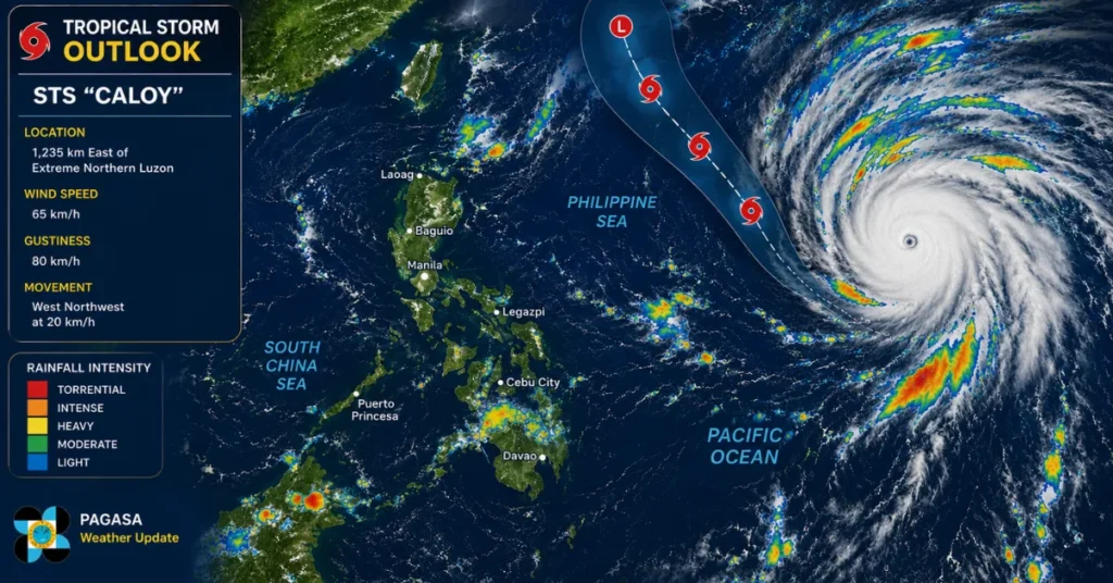
The tropical storm, which currently holds the international name Bavi, was tracked moving steadily across the Pacific Ocean. According to data from the Japan Meteorological Agency (JMA), the weather disturbance was spotted more than 3,700 kilometers east of Eastern Visayas. Because it is moving over highly favorable, warm ocean waters, the system is expected to rapidly gather strength over the next few days.
The official timeline for the storm’s progression includes:
- Monday: Projected to cross near the Northern Mariana Islands as a very strong typhoon.
- Wednesday/Thursday: Expected to formally cross into the Philippine Area of Responsibility (PAR).
- Local Naming: The moment it crosses the invisible PAR boundary, PAGASA will officially assign it the local name Bagyong Inday.
PAGASA weather specialist Leanne Loreto noted during a morning broadcast that while the storm’s path still carries a high degree of uncertainty, current steering currents point to a “no-landfall” scenario. The system is expected to curve upward and cross the northern portion of the Philippine Sea rather than slamming directly into any major local landmass.
The Hidden Threat: A Weakening Monsoonal Pull
Why a Super Typhoon Philippines Trajectory Enhances the Habagat
Even if Bagyong Inday stays safely out at sea, local communities cannot afford to let their guard down. The real danger for the western sections of Luzon, Visayas, and Mindanao lies in a weather phenomenon known as monsoonal enhancement. Because of its immense atmospheric pressure and rotation, a powerful system in the Philippine Sea acts like a giant vacuum, actively pulling the Southwest Monsoon (Habagat) straight toward the country.
Historical data compiled by Filipino meteorologists shows that roughly one-third of all rainfall recorded during the country’s wet season is directly tied to a tropical cyclone-enhanced Habagat. According to established meteorological studies, typhoons produce the maximum amount of monsoon enhancement when they position themselves perfectly between Northern Luzon and the Ryukyu Islands of southern Japan. Unfortunately, this is the exact zone that Bavi (Inday) is projected to cross.
Local residents remember the catastrophic damage of 2024, when a similar monsoonal pull by Super Typhoon Carina triggered three straight days of relentless, non-stop downpours. That event led to massive, neck-deep flooding across Metro Manila, Central Luzon, and CALABARZON, resulting in nearly 50 fatalities and over ₱10 billion in infrastructure and agricultural damage.
Read Also-MSI 2026 Schedule, Bracket, and Standings: Everything Pinoy LoL Fans Need to Know
PAGASA warns that a similar rainy pattern could emerge from the middle of next week through the weekend, bringing heavy, scattered rains to the western seaboards. In the meantime, the current Habagat cycle partially influenced by the recent exit of Tropical Depression Henry will continue to bring light to occasional heavy rains over Palawan and Occidental Mindoro, with localized thunderstorms affecting Metro Manila in the evenings. Stay alert, clear your community drainage systems, and keep tuning in to official government weather updates.
Frequently Asked Questions (FAQs)
Current PAGASA models predict a no-landfall scenario, with the storm likely curving toward the northern Philippine Sea.
Once the system officially enters the Philippine Area of Responsibility next week, it will be named Bagyong Inday.
The system is expected to severely enhance the Habagat (Southwest Monsoon), bringing intense, prolonged rainfall to western areas.
The western sections of the country, particularly Southern Luzon, Visayas, and Mindanao, should prepare for rain from midweek through the weekend.
PAGASA estimates that the weather disturbance will cross into the country’s monitoring domain by Wednesday or Thursday next week
Read Also- Enola Holmes 3 is Finally on Netflix: Plot, Cast, and What to Expect